
Tuesday 2 April 2013
Stratocumulus
Stratocumulus

Steepholm Island in the Bristol Channel photographed from Weston-Super-Mare one August. The sea is a little choppy with the wind increasing there were some showers around and not far away.
Cirrus

The Shard is claimed to be the tallest building in Western Europe at 310 metres; 1016 feet. Photographed here while still under construction it is clearly a dramatic addition to the London skyline and will provide a mixture of commercial and residential accommodation. I can only imagine the stunning views from the upper floors, unless they are shrouded in cloud that is!
Cirrus

Not too sure which variety; possibly Cirrus floccus.
Cirrus

I'm sure this is a Cirrus cloud but not too sure which variety. Cirrus clouds are always lovely to see as a sign of pleasant weather and can be at around 20,000ft.
Lower down there is (what appears to be) a string of Cumulus mediocris; a low hanging cloud which is sometimes grouped together by the wind. Otherwise earlier in the day they may have been Cumulus congests.
Cumulus humilis

Taken early one evening from Birdlip Hill, Gloucestershire and looking west. The photograph above is one of my favourite cloud shots of all time: I like it for the simplicity and the soft colours blending in with each other. These clouds float around at about 2,000ft give or take a little.
These clouds are still forming as their bases haven't come together completely. They're common in warm fine weather and sometimes rise further to become Cumulus mediocris or cumulus congestus if there has already been rain. Happily this didn't happen on this day, they rolled by as we drove home in lovely weather.

Cumulus congestus

The overall size of these can sometimes be stunning and you can almost see the internal convections taking place as the fluffy tops continue to bubble away.
Stratos nebulosus

I might have the classification of this completely wrong but I like the comical sheep if nothing else! It was taken early one still summer morning in Cumbria, UK. There were clumps of low level cloud floating around and very moist.
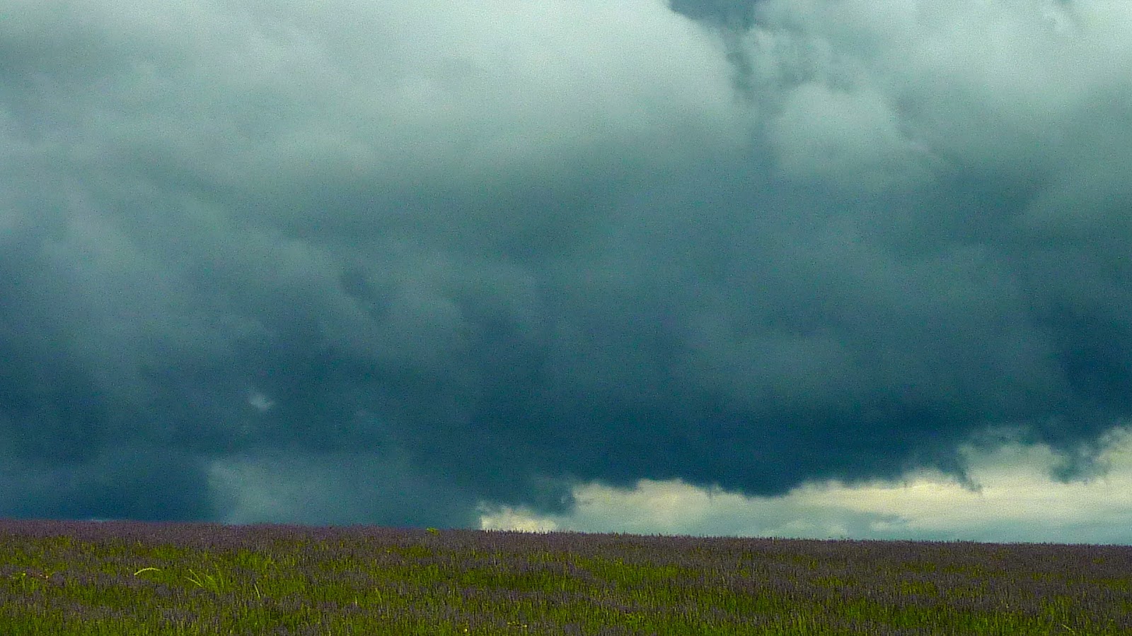
Stratocumulus

Heavy threatening clouds in the middle of an English summer! Stratocululus photographed with the Hitchin lavender fields in Hertfordshire UK in the foreground. We got very wet that day!
Cumulus mediocris

Cirrostratus

I think this is a straight forward Cirrostratus arrangement. They are high level clouds and the wispiness is clearly seen against a clear blue sky.
We're looking at ice crystals forming, often ahead of an incoming depression with its lower air pressure - a sure sign of this happening is seeing these clouds grow and thicken - a sure sign of poor weather approaching. There are variations of these clouds including Cirrocumulus which is a sure sign of approaching wet weather.
The added bonus with this photograph are the vapour condensation trails from aircraft which have passed overhead, also known as "contrails".
Monday 1 April 2013
Cumulonimbus calvus

Taken during mid October and includes a skyline in London with the magnificent St Paul's Cathedral on the left. Although it looked as if a shower may have been threatened, London stayed dry that day.
Stratus fractus

If you happen to be in this cloud, you'll only get wet through the drizzle like moisture as these are unlikely to be effective in producing rain as they pass over. It's possible the clouds above may cause rain and this will fall through the lower level Stratus fractus clouds in order to confuse people like me!
Cirrus fibratus

This was taken on the Mediterranean coast of Spain during a pleasant holiday at the end of October. The weather was fine but a depression arrived during the next few days.
These are lovely high level clouds at around 20,000 feet and are gradually invading the sky because of the approaching lower pressure. They sometimes thicken and form into thicker strands, gradually joining up.
You can see they are not alone as there are some lower level clouds creeping in on the right hand side which are possibly Cumulus.
Cumulonimbus capillatus

A dark brooding example somewhat exaggerated in monochrome which I occasionally use to photograph clouds. It's almost like a piece of Mahler's 5th symphony.
Although this is just a section, these can be huge structures towering vast heights into the sky. These often occur in the summer during hot stormy weather and often heavy rain storms will follow, possibly with hail or thunder. I love these!
These are energetic clouds arising from cumulus congests through powerful upward drafts which can develop into Cumulonimbus capillatus shown here.
Subscribe to:
Posts (Atom)